GIS, mapping and digital orthophotography
GIS database on wildlife along the Antarctic Peninsula
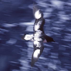
ERA has established a GIS database holding records of breeding wildlife colonies on the Antarctic Peninsula and surrrounding islands. The database was built to manage information for the Wildlife Awareness Manual commissioned by the Polar Regions Unit of the UK Foreign & Commonwealth Office, and published by ERA on 31 May 2006. Species included in the database are all species of penguin breeding in the region, southern giant petrels, Antarctic shags, southern fulmars and Antarctic fur seals. The database also includes information on the location of permanent stations in the region, protected areas and a range of historic sites.
Green Island
ERA developed a new digital orthophotograph for Green Island, Berthelot Islands, Antarctic Peninsula. Green Island is an Antarctic Specially Protected Area, and a new map was required for the revised management plan, which ERA prepared for the UK government. Click the map 'thumbnail' below to view the Green Island orthophoto at moderate resolution (pdf 2.6 MB).
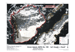
Green Island orthophoto
Features such as vegetation and even the seals (if you know where to find them!) are distinguishable in the pdf.
The source aerial photography was taken at an altitude of 4000 ft on 14 February 2001 by the British Antarctic Survey. The original orthoimage is exceptionally detailed, with a ground pixel resolution of 12 cm, showing vegetation cover and wildlife such as seals. At over 200 MB, however, the full orthoimage is not available on-line.
